


Community Calendar
MAY 17
Neal Center YMCA, Courthouse Square, Toledo, IL, USA
MAY 22
Charleston Carnegie Public Library, Charleston, IL, USA
MAY 22
Burgess Auditorium, Wabash Avenue, Mattoon, IL, USA
Financial Ticker

Social
Severe Thunderstorm Warning
ILC025-049-079-162145-
/O.NEW.KILX.SV.W.0115.250516T2106Z-250516T2145Z/
BULLETIN - IMMEDIATE BROADCAST REQUESTED
Severe Thunderstorm Warning
National Weather Service Lincoln IL
406 PM CDT Fri May 16 2025
The National Weather Service in Lincoln has issued a
* Severe Thunderstorm Warning for...
Jasper County in southeastern Illinois...
Northeastern Clay County in south central Illinois...
Southeastern Effingham County in south central Illinois...
* Until 445 PM CDT.
* At 406 PM CDT, a severe thunderstorm was located over Bible Grove,
or 14 miles north of Flora, moving northeast at 60 mph.
HAZARD...60 mph wind gusts and quarter size hail.
SOURCE...Radar indicated.
IMPACT...Hail damage to vehicles is expected. Expect wind damage
to roofs, siding, and trees.
* This severe thunderstorm will be near...
Bible Grove around 410 PM CDT.
Newton and Bogota around 420 PM CDT.
PRECAUTIONARY/PREPAREDNESS ACTIONS...
A Tornado Watch remains in effect until 1000 PM CDT for south central
and southeastern Illinois.
&&
LAT...LON 3889 8861 3915 8795 3892 8795 3877 8855
TIME...MOT...LOC 2106Z 243DEG 50KT 3888 8849
HAIL THREAT...RADAR INDICATED
MAX HAIL SIZE...1.00 IN
WIND THREAT...RADAR INDICATED
MAX WIND GUST...60 MPH
$$
25
Tornado Warning
ILC005-027-051-121-162100-
/O.NEW.KLSX.TO.W.0066.250516T2018Z-250516T2100Z/
BULLETIN - EAS ACTIVATION REQUESTED
Tornado Warning
National Weather Service St Louis MO
318 PM CDT Fri May 16 2025
The National Weather Service in St Louis has issued a
* Tornado Warning for...
Southeastern Bond County in south central Illinois...
Northeastern Clinton County in south central Illinois...
Southwestern Fayette County in south central Illinois...
Northwestern Marion County in south central Illinois...
* Until 400 PM CDT.
* At 318 PM CDT, a severe thunderstorm capable of producing a
tornado was located near Beaver Creek, or 7 miles north of
Carlyle, moving northeast at 40 mph.
HAZARD...Tornado and quarter size hail.
SOURCE...Radar indicated rotation.
IMPACT...Flying debris will be dangerous to those caught
without shelter. Mobile homes will be damaged or
destroyed. Damage to roofs, windows and vehicles will
occur. Tree damage is likely.
* Locations impacted include...
Carlyle, Kinmundy, Brownstown, Patoka, Tamalco, Beaver Creek,
Shobonier, Boulder, Pittsburg, Keyesport, St. Peter, Vernon and
St. Paul.
This includes the following State Parks...
Carlyle Lake Recreational Area.
This includes the following highways...
Interstate 70 in Illinois near exit 68.
Interstate 57 in Illinois near exit 127.
PRECAUTIONARY/PREPAREDNESS ACTIONS...
Torrential rainfall is also occurring with this storm and may lead
to flash flooding. Do not drive your vehicle through flooded
roadways.
&&
LAT...LON 3874 8945 3876 8946 3901 8894 3876 8879
3864 8938
TIME...MOT...LOC 2017Z 242DEG 36KT 3871 8935
TORNADO...RADAR INDICATED
MAX HAIL SIZE...1.00 IN
$$
Kimble
Severe Thunderstorm Warning
ILC115-139-147-173-162145-
/O.NEW.KILX.SV.W.0114.250516T2102Z-250516T2145Z/
BULLETIN - IMMEDIATE BROADCAST REQUESTED
Severe Thunderstorm Warning
National Weather Service Lincoln IL
402 PM CDT Fri May 16 2025
The National Weather Service in Lincoln has issued a
* Severe Thunderstorm Warning for...
Northwestern Moultrie County in central Illinois...
North central Shelby County in central Illinois...
Southern Piatt County in central Illinois...
Southeastern Macon County in central Illinois...
* Until 445 PM CDT.
* At 402 PM CDT, a severe thunderstorm was located over Macon, or 12
miles south of Decatur, moving northeast at 55 mph.
HAZARD...60 mph wind gusts and quarter size hail.
SOURCE...Radar indicated.
IMPACT...Hail damage to vehicles is expected. Expect wind damage
to roofs, siding, and trees.
* This severe thunderstorm will be near...
Mount Zion and Macon around 405 PM CDT.
Decatur, Long Creek, and Dalton City around 410 PM CDT.
Cerro Gordo around 420 PM CDT.
Other locations in the path of this severe thunderstorm include
Bement, Monticello and Ivesdale.
This includes Interstate 72 between mile markers 161 and 166.
PRECAUTIONARY/PREPAREDNESS ACTIONS...
For your protection move to an interior room on the lowest floor of a
building.
Large hail, damaging wind, and continuous cloud to ground lightning
are occurring with this storm. Move indoors immediately. Lightning is
one of nature`s leading killers. Remember, if you can hear thunder,
you are close enough to be struck by lightning.
A Tornado Watch remains in effect until 1000 PM CDT for central and
east central Illinois.
&&
LAT...LON 3957 8898 3961 8903 3965 8902 3966 8908
3967 8910 4009 8860 3996 8846 3983 8846
TIME...MOT...LOC 2102Z 229DEG 49KT 3968 8898
HAIL THREAT...RADAR INDICATED
MAX HAIL SIZE...1.00 IN
WIND THREAT...RADAR INDICATED
MAX WIND GUST...60 MPH
$$
25
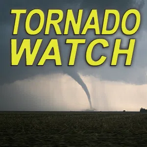
The National Weather Service has issued a Tornado Watch, until 10pm, for our entire listening area.


Tornado Warning
ILC025-035-049-079-162130-
/O.NEW.KILX.TO.W.0045.250516T2047Z-250516T2130Z/
BULLETIN - EAS ACTIVATION REQUESTED
Tornado Warning
National Weather Service Lincoln IL
347 PM CDT Fri May 16 2025
The National Weather Service in Lincoln has issued a
* Tornado Warning for...
Northwestern Jasper County in southeastern Illinois...
Southwestern Cumberland County in east central Illinois...
Northwestern Clay County in south central Illinois...
Effingham County in south central Illinois...
* Until 430 PM CDT.
* At 346 PM CDT, a severe thunderstorm capable of producing a tornado
was located near Farina, or 15 miles southeast of Vandalia, moving
northeast at 65 mph.
HAZARD...Tornado.
SOURCE...Radar indicated rotation.
IMPACT...Flying debris will be dangerous to those caught without
shelter. Mobile homes will be damaged or destroyed.
Damage to roofs, windows, and vehicles will occur. Tree
damage is likely.
* This dangerous storm will be near...
Edgewood and Mason around 355 PM CDT.
Watson around 400 PM CDT.
Heartville around 405 PM CDT.
Other locations in the path of this tornadic thunderstorm include
Dieterich and Wheeler.
This includes the following highways...
Interstate 57 between mile markers 142 and 165.
Interstate 70 between mile markers 84 and 107.
PRECAUTIONARY/PREPAREDNESS ACTIONS...
TAKE COVER NOW! Move to a basement or an interior room on the lowest
floor of a sturdy building. Avoid windows. If you are outdoors, in a
mobile home, or in a vehicle, move to the closest substantial shelter
and protect yourself from flying debris.
To report severe weather contact your nearest law enforcement agency.
They will send your report to the National Weather Service office in
Lincoln.
Torrential rainfall is occurring with this storm, and may lead to
flash flooding. Do not drive your vehicle through flooded roadways.
&&
LAT...LON 3891 8870 3891 8881 3900 8880 3925 8840
3904 8815 3884 8870
TIME...MOT...LOC 2046Z 239DEG 57KT 3886 8885
TORNADO...RADAR INDICATED
MAX HAIL SIZE...<.75 IN
$$
25
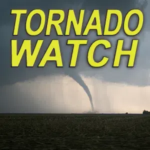
National Weather Service has issued a tornado watch, until 10pm.