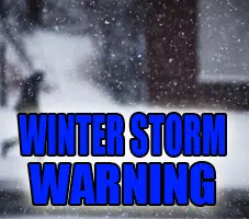
URGENT - WINTER WEATHER MESSAGE
National Weather Service Lincoln IL
227 AM CST Fri Jan 23 2026

ILZ042>057-061>063-066>068-071>073-232200-
/O.CON.KILX.WS.W.0001.260124T1500Z-260126T0600Z/
Logan-De Witt-Piatt-Champaign-Vermilion-Cass-Menard-Scott-Morgan-Sangamon-Christian-Macon-Moultrie-Douglas-Coles-Edgar-Shelby-
Cumberland-Clark-Effingham-Jasper-Crawford-Clay-Richland-Lawrence-
Including the cities of Springfield, Winchester, Taylorville, Effingham, Urbana, Paris, Danville, Jacksonville, Mattoon,
Sullivan, Lawrenceville, Flora, Petersburg, Monticello, Decatur, Newton, Shelbyville, Clinton, Marshall, Champaign, Lincoln,
Robinson, Tuscola, Greenup, Beardstown, Olney, and Charleston
227 AM CST Fri Jan 23 2026

...WINTER STORM WARNING REMAINS IN EFFECT FROM 9 AM SATURDAY TO MIDNIGHT CST SUNDAY NIGHT...

* WHAT...Heavy snow expected. Total snow accumulations between 5 and 9 inches.

* WHERE...Portions of central, east central, southeast, and west central Illinois.

* WHEN...From 9 AM Saturday to midnight CST Sunday Night.

* IMPACTS...Travel could be very difficult.

PRECAUTIONARY/PREPAREDNESS ACTIONS...

If you must travel, keep an extra flashlight, food, and water in your vehicle in case of an emergency. The latest road conditions for
Illinois can be obtained on the Internet at www.gettingaroundillinois.com

&&

$$


Comments