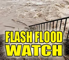
ILZ043>046-052>057-061>063-066>068-071>073-091200-
/O.CON.KILX.FF.A.0004.000000T0000Z-180909T1200Z/
/00000.0.ER.000000T0000Z.000000T0000Z.000000T0000Z.OO/
De Witt-Piatt-Champaign-Vermilion-Christian-Macon-Moultrie-
Douglas-Coles-Edgar-Shelby-Cumberland-Clark-Effingham-Jasper-
Crawford-Clay-Richland-Lawrence-
Including the cities of Clinton, Monticello, Champaign, Urbana,
Danville, Taylorville, Decatur, Sullivan, Tuscola, Charleston,
Mattoon, Paris, Shelbyville, Greenup, Marshall, Effingham,
Newton, Robinson, Flora, Olney, and Lawrenceville
407 PM CDT Sat Sep 8 2018

...FLASH FLOOD WATCH REMAINS IN EFFECT THROUGH SUNDAY MORNING...

The Flash Flood Watch continues for

* Portions of central Illinois, east central Illinois, and
  southeast Illinois, including the following areas, in central
  Illinois, Christian, De Witt, Macon, Piatt, and Shelby. In
  east central Illinois, Champaign, Clark, Coles, Cumberland,
  Douglas, Edgar, Moultrie, and Vermilion. In southeast
  Illinois, Clay, Crawford, Effingham, Jasper, Lawrence, and
  Richland.

* Through Sunday morning

* Additional rainfall of 1 to 3 inches is likely through tonight
  along the I-70 corridor, as far north as Paris and as far south
  as Flora and Lawrenceville. Further north, additional amounts of
  up to an inch are possible, in an area that already received 3
  to 5 inches of rain on Friday.

* Flooding of low lying areas, and near rivers and streams, is
  likely. More widespread flooding will occur in some areas with
  such heavy amounts expected.

PRECAUTIONARY/PREPAREDNESS ACTIONS...

A Flash Flood Watch means that conditions may develop that lead
to flash flooding. Flash flooding is a VERY DANGEROUS SITUATION.

You should monitor later forecasts and be prepared to take action
should Flash Flood Warnings be issued.

&&

$$
Hazardous Weather Outlook
Hazardous Weather Outlook
National Weather Service Lincoln IL
343 PM CDT Sat Sep 8 2018

ILZ043>046-052>057-061>063-066>068-071>073-091100-
Champaign-Christian-Clark-Clay-Coles-Crawford-Cumberland-De Witt-
Douglas-Edgar-Effingham-Jasper-Lawrence-Macon-Moultrie-Piatt-
Richland-Shelby-Vermilion-
343 PM CDT Sat Sep 8 2018

...FLASH FLOOD WATCH IN EFFECT THROUGH SUNDAY MORNING...

This Hazardous Weather Outlook is for portions of central
Illinois, east central Illinois and southeast Illinois.

.DAY ONE...TONIGHT...

Moderate flooding is expected along portions of the Embarras,
and Little Wabash basins through the weekend.

Periods of rain will occur across the area into tonight. However,
additional rainfall amounts will be less than one half inch.
Some areas of southeast Illinois received 6 to 8 inches of rain
over the past 24 hours so significant rises are expected to
continue along area rivers, creeks and streams in addition to
flooding over area roadways.

.DAYS TWO THROUGH SEVEN...SUNDAY THROUGH FRIDAY...

No hazardous weather is expected.

.SPOTTER INFORMATION STATEMENT...

Spotter activation is not anticipated at this time.

$$

Smith


