From the National Weather Service: Periods of Heavy Rainfall Expected Tuesday into Wednesday Evening
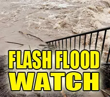
FLASH FLOOD WATCH IN EFFECT FROM THIS EVENING THROUGH WEDNESDAY EVENING…
The National Weather Service in Lincoln has expanded the Flash Flood Watch to include portions of central Illinois, east central Illinois, southeast Illinois, and west central
Illinois, including the following areas, in central Illinois, Christian, De Witt, Logan, Macon, Mason, McLean, Menard, Piatt, Sangamon, Shelby, Tazewell, and Woodford. In east central Illinois, Champaign, Coles, Cumberland, Douglas, and Moultrie. In southeast Illinois, Clay, Effingham, and Jasper. In west central Illinois, Cass, Morgan, and Scott.
* From this evening through Wednesday evening
* A stationary front across the region will provide a focus for the development of periods of heavy precipitation tonight through Wednesday evening. The potential for several inches of rain falling on already saturated ground may lead to flash flooding.
PRECAUTIONARY/PREPAREDNESS ACTIONS… A Flash Flood Watch means that conditions may develop that lead to flash flooding. Flash flooding is a VERY DANGEROUS SITUATION.
You should monitor later forecasts and be prepared to take action should Flash Flood Warnings be issued.


