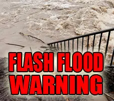
Flash Flood Statement
National Weather Service St Louis MO
625 AM CDT Mon Aug 12 2019
ILC005-027-051-117-121-135-121530-
/O.CON.KLSX.FF.W.0034.000000T0000Z-190812T1530Z/
/00000.0.ER.000000T0000Z.000000T0000Z.000000T0000Z.OO/
Clinton IL-Bond IL-Marion IL-Fayette IL-Macoupin IL-Montgomery IL-
625 AM CDT Mon Aug 12 2019
…THE FLASH FLOOD WARNING REMAINS IN EFFECT UNTIL 1030 AM CDT FOR CLINTON…BOND…MARION…WESTERN FAYETTE…SOUTHEASTERN MACOUPIN AND SOUTHERN MONTGOMERY COUNTIES…
At 611 AM CDT, Doppler radar indicated thunderstorms producing heavy rain across the warned area. Numerous reports of flash flooding and roads closed due to flooding have been received across the warned area, particularly across Bond County. Additional significant rainfall will continue across the warned area.
Some locations that will experience flooding include… Salem, Greenville, Litchfield, Hillsboro, Staunton, Gillespie, Mount Olive, Benld, St. Rose, Sandoval, Central City, Odin, Beckemeyer, Ramsey and Witt.
This includes the following highways… Interstate 70 in Illinois between exits 36 and 68.
Interstate 55 in Illinois between exits 41 and 52.
Interstate 57 in Illinois between exits 116 and 127.
This also includes Ramsey Lake State Park, Lake Lou Yaeger, and Carlyle Lake Recreational Area.
PRECAUTIONARY/PREPAREDNESS ACTIONS…
Turn around, don`t drown when encountering flooded roads. Most flood deaths occur in vehicles.
Be especially cautious at night when it is harder to recognize the dangers of flooding.
Please report flooding to your local law enforcement agency when you can do so safely.
&&
LAT…LON 3851 8924 3852 8936 3849 8941 3871 8960 3887 8960 3888 8964 3900 8964 3901 8991 3927 8996 3926 8927 3912 8905 3857 8879
$$


