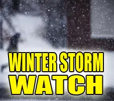
URGENT - WINTER WEATHER MESSAGE
National Weather Service Lincoln IL
1259 PM CST Thu Jan 22 2026

A long duration winter storm will bring heavy snow to parts of central and southeast Illinois this weekend in the form of two
waves. The first will come Saturday morning through early Saturday evening. After a brief lull Saturday night, the bigger push of snow
will come early Sunday morning continuing through Sunday afternoon.

ILZ044>046-049>057-061>063-231000-
/O.EXB.KILX.WS.A.0001.260124T1200Z-260126T0000Z/
Piatt-Champaign-Vermilion-Scott-Morgan-Sangamon-Christian-Macon-Moultrie-Douglas-Coles-Edgar-Shelby-Cumberland-Clark-
Including the cities of Winchester, Charleston, Marshall, Danville, Springfield, Sullivan, Decatur, Urbana, Shelbyville,
Taylorville, Tuscola, Champaign, Monticello, Greenup, Mattoon, Jacksonville, and Paris
1259 PM CST Thu Jan 22 2026

...WINTER STORM WATCH IN EFFECT FROM SATURDAY MORNING THROUGH SUNDAY AFTERNOON...

* WHAT...Heavy snow possible. Total snow accumulations between 5 and 7 inches possible.

* WHERE...Portions of central, east central, and west central Illinois.

* WHEN...From Saturday morning through Sunday afternoon.

* IMPACTS...Plan on slippery road conditions.

PRECAUTIONARY/PREPAREDNESS ACTIONS... Monitor the latest forecasts for updates on this situation.
&&

$$


Comments