National Weather Service of Central Illinois Facebook Page
According to the National Weather Service of Central Illinois Facebook page:
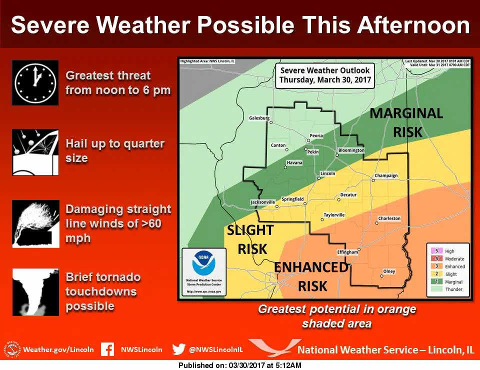
A slow moving weather system will track across central Illinois this afternoon. Warm, moist air ahead of this system will interact with a cold front that will move through the area and produce showers and thunderstorms this afternoon. These storms are expected to be severe this afternoon as they move across central and southeast Illinois. The area with the greatest potential for severe storms will be south of a Taylorville to Danville line, though areas to the north of this line are in a Slight Risk and could also see severe weather this afternoon. The main severe weather threat will be damaging winds and large hail; however, a brief tornado is possible, especially in the Enhanced Risk area. The time period when the severe weather threat is the greatest will be from noon to 6 pm. People across central and southeast Illinois should remain alert and keep abreast of the severe weather potential for this afternoon.
Follow the National Weather Service of Central Illinois on Facebook here.


