Update:
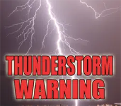
Severe Thunderstorm Warning
ILC173-262100-
/O.NEW.KILX.SV.W.0103.210826T2036Z-210826T2100Z/

BULLETIN - IMMEDIATE BROADCAST REQUESTED
Severe Thunderstorm Warning
National Weather Service Lincoln IL
336 PM CDT Thu Aug 26 2021

The National Weather Service in Lincoln has issued a

* Severe Thunderstorm Warning for...
  Southwestern Shelby County in central Illinois...

* Until 400 PM CDT.

* At 335 PM CDT, a severe thunderstorm was located near Shelbyville,
  moving southeast at 15 mph.

  HAZARD...60 mph wind gusts and penny size hail.

  SOURCE...Radar indicated.

  IMPACT...Expect damage to roofs, siding, and trees.

* This severe thunderstorm will be near...
  Cowden around 350 PM CDT.

Other locations in the path of this severe thunderstorm include
Stewardson.

PRECAUTIONARY/PREPAREDNESS ACTIONS...

For your protection move to an interior room on the lowest floor of a
building.

Large hail and damaging winds and continuous cloud to ground
lightning is occurring with this storm. Move indoors immediately.
Lightning is one of nature`s leading killers. Remember, if you can
hear thunder, you are close enough to be struck by lightning.

Torrential rainfall is occurring with this storm, and may lead to
flash flooding. Do not drive your vehicle through flooded roadways.

&&

LAT...LON 3922 8899 3946 8902 3947 8901 3953 8884
      3922 8857
TIME...MOT...LOC 2035Z 323DEG 14KT 3936 8882

HAIL THREAT...RADAR INDICATED
MAX HAIL SIZE...0.75 IN
WIND THREAT...RADAR INDICATED
MAX WIND GUST...60 MPH


Earlier:
The National Weather Service in Lincoln has issued a * Severe Thunderstorm Warning for... West central Coles County in east central Illinois... Southern Moultrie County in central Illinois... Northeastern Shelby County in central Illinois... * Until 345 PM CDT. * At 311 PM CDT, a severe thunderstorm was located near Windsor, or near Sullivan, moving southeast at 20 mph. HAZARD...60 mph wind gusts. SOURCE...Radar indicated. IMPACT...Expect damage to roofs, siding, and trees. * This severe thunderstorm will be near... Allenville around 315 PM CDT. Windsor around 325 PM CDT. Other locations in the path of this severe thunderstorm include Mattoon. PRECAUTIONARY/PREPAREDNESS ACTIONS... For your protection move to an interior room on the lowest floor of a building. Torrential rainfall is occurring with this storm, and may lead to flash flooding. Do not drive your vehicle through flooded roadways.


Comments